
UU
AgTech
3
Providers
Free
Quote requests
100%
Verified
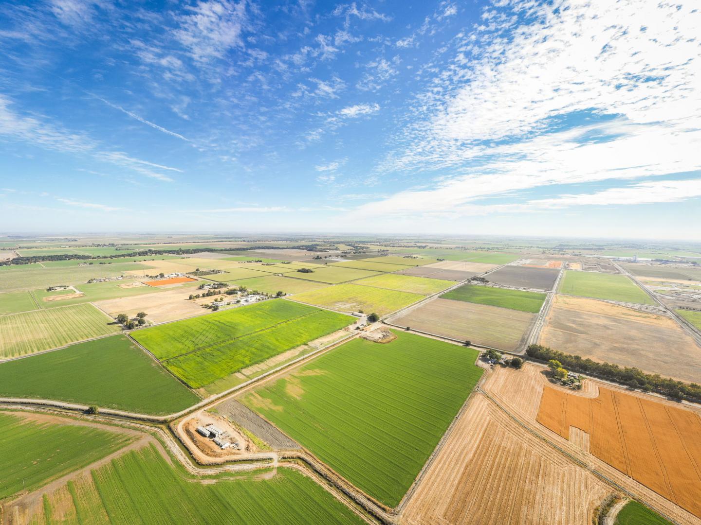
Drone orthomosaic mapping services from Agnomys provide high-resolution, georeferenced aerial imagery to help farmers visualize, measure, and manage their land with greater precision and efficiency.
Verified providers
Pick the providers you want to hear from. Send your details once and receive quotes from everyone you select.
3 available
Same category

Drone fertilizer application provides precise, efficient nutrient distribution, improving crop health, reducing waste, and enhancing overall farm productivity.

Drone service providers offer efficient pest survey solutions, using aerial imagery and multispectral sensors to detect infestations and guide targeted pest control strategies.

Drone pesticide application provides precise, efficient, and environmentally friendly crop protection by reducing chemical waste, minimizing labor costs, and ensuring optimal coverage.

Drone sanitization services provide efficient, aerial disinfection for agricultural spaces, equipment, and livestock areas, ensuring a cleaner and healthier environment with optimized chemical use.

Drone nutrient services provide precise and efficient aerial application of essential nutrients, optimizing crop health, reducing waste, and promoting sustainable farming practices.

Agnomys connects farmers with drone service providers to inspect, analyze, and document irrigation systems using aerial video and imagery for efficient water distribution and system performance.

Drone multispectral survey services from Agnomys provide high-resolution insights into crop health, soil conditions, and field variability to support precision agriculture and smarter farming decisions.

Agnomys connects farmers with drone service providers who capture high-resolution aerial photos and videos for crop monitoring, project tracking, and marketing content.
Show all
Overview
“Drone orthomosaic mapping services deliver accurate, high-resolution aerial imagery stitched into detailed, georeferenced maps of your fields”
Drone orthomosaic mapping services deliver accurate, high-resolution aerial imagery stitched into detailed, georeferenced maps of your fields. Agnomys service providers use cutting-edge drone technology to help farmers visualize, measure, and manage their land with precision.
Services include:
High-Resolution Field Maps: Create clear, detailed maps for analysis and planning.
Georeferenced Imagery: Accurate spatial data for measuring distances, areas, and crop zones.
Field Boundary Mapping: Precisely define and update field edges and property lines.
Infrastructure Monitoring: Assess roads, irrigation lines, and other assets from above.
Land Use Planning: Support planting, ripping, or development decisions with up-to-date visuals.
Change Detection: Compare historical maps to track seasonal or structural changes.
Integration with GIS Tools: Use orthomosaics in precision ag software for deeper insights.
Agnomys helps farmers access professional drone orthomosaic mapping services for better planning, monitoring, and land management.
Compare 3 verified providers, see transparent pricing, and lock in your window.
Drone Orthomosaic Mapping
From the blog
Field notes, seasonal guides, and grower interviews — straight from the team.
 Best Practices
Peach harvest season is approaching across California. This guide covers harvest timing, labor planning, hauling, equipment support, processing considerations, and the key services growers should secure before harvest begins.
 Industry News
USDA has officially released enrollment dates and payment rates for the Assistance for Specialty Crop Farmers (ASCF) Program. This guide explains who qualifies, eligible crops, payment amounts, important deadlines, and what California growers should do next.
 Industry News
Agnomy was awarded the grand prize at the AWS AI Pitch Competition hosted with AWS, nClouds, AllCode, and the California Capital Women’s Business Center. Built by farmers for farmers, Agnomy is focused on helping growers and service providers better coordinate agricultural work when timing matters most.


