
TA
AgTech
2
Providers
Free
Quote requests
100%
Verified
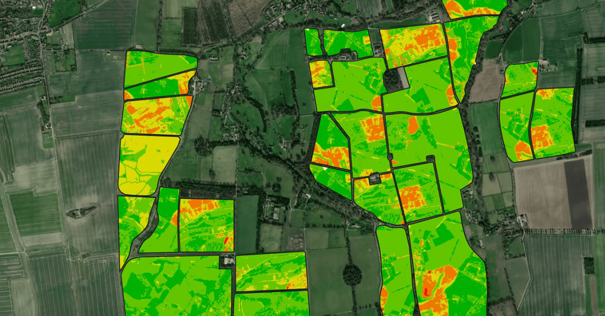
Aerial imagery services provide high-resolution drone and satellite data to help farmers monitor crop health, assess field conditions, optimize irrigation, and improve overall farm management.
Same category

Ag automation services enhance farming efficiency by utilizing precision technology, automated irrigation, smart harvesting, robotics, and data-driven management to optimize productivity and reduce labor costs.

GPS soil sampling uses advanced technology to analyze soil conditions with precision, providing farmers with detailed data on nutrients, pH levels, and moisture to optimize crop management and sustainability.

EC Mapping services use advanced technology to analyze soil variability, helping farmers optimize irrigation, fertilization, and crop management for improved yields and efficiency.
Overview
“Agnomy’s ag aerial imagery services offer high-resolution, data-driven insights to help farmers monitor crop health, assess field conditions, and optimize farm management”
Agnomy’s ag aerial imagery services offer high-resolution, data-driven insights to help farmers monitor crop health, assess field conditions, and optimize farm management. Service providers use cutting-edge drone and satellite technology to deliver accurate and timely imaging for better decision-making.
With ag aerial imagery services, farmers can make data-backed decisions to increase efficiency, reduce costs, and improve overall productivity.
Compare 2 verified providers, see transparent pricing, and lock in your window.
Aerial Imagery
From the blog
Field notes, seasonal guides, and grower interviews — straight from the team.
 Best Practices
Peach harvest season is approaching across California. This guide covers harvest timing, labor planning, hauling, equipment support, processing considerations, and the key services growers should secure before harvest begins.
 Industry News
USDA has officially released enrollment dates and payment rates for the Assistance for Specialty Crop Farmers (ASCF) Program. This guide explains who qualifies, eligible crops, payment amounts, important deadlines, and what California growers should do next.
 Industry News
Agnomy was awarded the grand prize at the AWS AI Pitch Competition hosted with AWS, nClouds, AllCode, and the California Capital Women’s Business Center. Built by farmers for farmers, Agnomy is focused on helping growers and service providers better coordinate agricultural work when timing matters most.

